Key News Bulletins & Findings
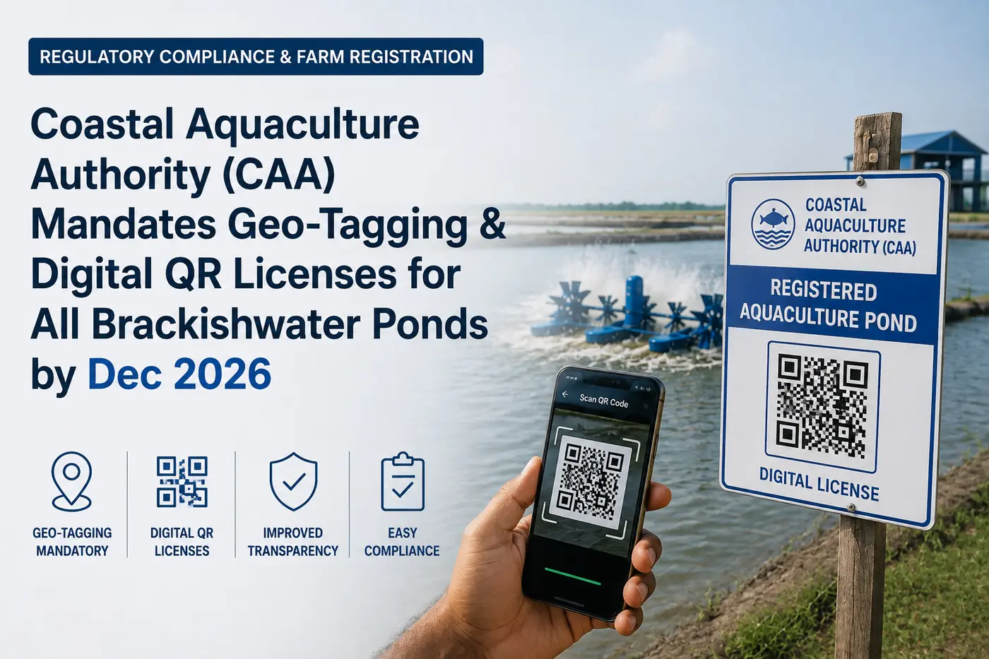
- CAA issues mandatory gazette notification requiring all coastal shrimp and fish farms to complete GIS polygon geo-tagging by December 31, 2026.
- Geo-tagged ponds receive a cryptographically verified Digital QR License, conferring formal legal recognition and permanent immunity from administrative demolition or power cut actions.
- Unlocks direct farmer eligibility for subsidized ₹1.50/unit electricity tariffs, PMMSY capital subsidies, and ₹3 Lakh Kisan Credit Card (KCC) loans.
- Mandatory for export batch generation; unregistered farms will be barred from selling to MPEDA-registered seafood processing facilities starting in 2027.
1. The Statutory Gazette Mandate: CAA Act Amendments & Timelines
The Ministry of Fisheries, Animal Husbandry and Dairying, through the Coastal Aquaculture Authority (CAA) Headquarters in Chennai, has officially published landmark statutory rules under the Coastal Aquaculture Authority (Amendment) Act. The notification establishes a mandatory national framework requiring every commercial brackishwater shrimp, finfish, and crab aquaculture farm operating in coastal states to undergo satellite GIS polygon mapping and transition to dynamic, QR-coded Digital Farm Licenses by December 31, 2026.
Historically, coastal aquaculture licensing in India relied on physical, paper-based permits issued by District Level Committees (DLCs) and State Level Committees (SLCs). These traditional paper certificates lacked precise geospatial coordinates, leading to chronic administrative ambiguities regarding Coastal Regulation Zone (CRZ) buffer compliance, mangrove proximity disputes, and unauthorized power connections.
Under the new mandate, all existing paper registrations will be systematically converted into unique 14-digit Digital Aquaculture Identification Numbers (DAINs) linked directly to satellite-verified GPS perimeter polygons. The initiative covers over 85,000 hectares of active culture area across Andhra Pradesh, Gujarat, Tamil Nadu, Odisha, West Bengal, Kerala, Karnataka, and Maharashtra.
2. GIS Polygon Mapping: How Satellite Geo-Fencing Works
Unlike standard GPS single-point geo-tagging, the CAA digital system utilizes high-resolution multi-point GIS polygon mapping. Authorized field survey teams—comprising Village Fisheries Assistants (VFAs) and revenue surveyors—record the precise latitude and longitude coordinates of all corner boundary dykes of each individual pond.
These coordinate vectors are uploaded directly to the CAA National Geospatial Aquaculture Database, integrated with the National Remote Sensing Centre (NRSC) and Bhuvan ISRO satellite mapping platforms. The system automatically creates a digital geo-fence around the farm holding.
Automated satellite algorithms cross-reference the farm boundary against High Tide Line (HTL) buffer data, designated mangrove reserves, and eco-sensitive zones, establishing absolute legal certainty that the farm operates in full compliance with environmental and CRZ regulations.
3. Legal Immunities, Power Connections & Kisan Credit Card (KCC) Access
The issuance of a Digital QR License confers immense legal and economic benefits upon the farm operator, transforming aquaculture from an informal rural activity into a formally protected agro-enterprise:
1. Statutory Legal Immunity: Geo-tagged farms enjoy permanent statutory protection against arbitrary demolition orders or notice actions from local revenue departments, provided culture practices adhere to CAA effluent and biosecurity guidelines.
2. Seamless Power Subsidy Integration: DISCOMs (such as APSPDCL, APEPDCL, and DGVCL) are directly linked via API to the CAA database. Scanning the farm's QR code instantly verifies active registration, enabling immediate activation of the subsidized ₹1.50/unit agro-aquaculture power tariff without requiring manual departmental NoC certificates.
3. Collateral-Free Bank Financing: Public sector banks (SBI, Canara Bank, Union Bank) and regional rural banks accept the CAA Digital QR Certificate as definitive proof of commercial agro-holding, unlocking pre-approved Kisan Credit Card (KCC) loans of up to ₹3,00,000 at a subsidized 4% effective annual interest rate.
4. Global Export Traceability: Meeting EU & US Supply Chain Standards
International seafood buyers and regulatory authorities—including the European Commission (DG SANTE) and the US Food and Drug Administration (USFDA)—are increasingly demanding end-to-end digital farm-to-fork traceability for imported warmwater shrimp.
Under the upgraded Pre-Harvest Certificate (PHC) protocol administered by MPEDA, laboratory test reports for antibiotic residues will be cryptographically bound to the farm's Digital Aquaculture Identification Number (DAIN) and GPS polygon. When processing plants package frozen shrimp for international export, container barcodes will link directly back to the verified pond coordinate.
Starting January 1, 2027, MPEDA-registered processing factories will be legally prohibited from procuring harvest biomass from unregistered or non-geo-tagged ponds, making digital compliance a strict commercial prerequisite for accessing export markets.
5. Step-by-Step SOP for Farmers: Applying on the CAA Digital Portal
Farmers with existing valid licenses or new applicants can complete the digital geo-tagging process through the following standardized workflow:
1. Digital Registration: Visit the official CAA portal (caa.gov.in) and register using your mobile number and Aadhaar e-KYC. Enter pond location details, land survey numbers, water source (estuary/creek/borewell), and operational species.
2. Document Upload: Attach scanned copies of the Land Title Deed (Patta/Adangal/RoR) or Registered Lease Agreement (minimum 3 years validity), water test report, and pond layout sketch.
3. On-Site GPS Survey: The District Level Committee will schedule an on-site physical survey within 14 working days. The Village Fisheries Assistant will walk the pond perimeter with a handheld differential GPS device to capture boundary vertices.
4. QR License Download: Upon DLC verification and Member Secretary digital signature, the official CAA Digital License (PDF with encrypted QR code) is issued online within 30 days.
Market Data & Rates Breakdown
| Regulatory Parameter | Pre-Reform Paper License | New Geo-Tagged Digital QR License | Direct Farmer Benefit / Legal Status |
|---|---|---|---|
| Licensing Format | Physical paper booklet with manual stamp | Tamper-proof Digital PDF with encrypted QR code | Instant smartphone verification by DISCOM & banks |
| Pond Boundary Mapping | Approximate revenue survey numbers only | Multi-point GPS polygon satellite coordinate mapping | Eliminates boundary disputes & CRZ overlap ambiguities |
| Electricity Tariff Access | Requires manual NoC from multiple depts | Instant auto-verification on DISCOM portals | Guaranteed subsidized ₹1.50/unit aqua tariff slab |
| Institutional Bank Credit | High rejection rates due to unregistered status | Pre-approved Kisan Credit Card (KCC) eligibility | Collateral-free working capital up to ₹3,00,000 @ 4% |
| Export Factory Acceptance | Manual Pre-Harvest Certificate (PHC) physical paper | Digital trace batch linked directly to pond GPS | 100% Grade-A export processing procurement eligibility |
The digitization of India's 85,000+ hectares of brackishwater aquaculture through satellite geo-tagging marks the transition from an unorganized rural sector to a formally recognized agricultural industry. Farms that secure digital QR licenses by December 2026 will enjoy uninterrupted subsidized power, priority export factory bidding, and seamless access to low-interest working capital, while unregistered farms risk total exclusion from international supply chains.
Immediate Farmer Action Plan
Frequently Asked Questions
Q: Is geo-tagging mandatory for ponds operating on private agricultural land?
Yes. Under the Coastal Aquaculture Authority (Amendment) Act, all brackishwater shrimp, crab, and finfish aquaculture activities conducted within coastal districts require mandatory CAA registration and satellite geo-tagging, regardless of whether the land is privately owned patta land or leased government land.
Q: What happens if a farmer fails to complete geo-tagging before the December 31, 2026 deadline?
Farms that fail to complete digital registration by the December 31, 2026 deadline will be classified as unauthorized holdings. They will lose access to subsidized ₹1.50/unit electricity tariffs, face automatic rejection of Pre-Harvest Certificates (PHC) by MPEDA laboratories, and be legally barred from selling harvest biomass to export processing plants.
Q: Can farms located within 200 meters of the High Tide Line (HTL) obtain a CAA license?
Under amended CRZ and CAA guidelines, hatcheries, broodstock multiplication centers, and traditional ecologically compliant aquaculture ponds are permissible within specific coastal zones provided they possess adequate effluent treatment systems (ETPs) and do not encroach upon classified mangrove forests.
Q: How much does the official CAA digital registration and geo-tagging process cost?
The government statutory fee for CAA registration is nominal: ₹500 per hectare for smallholder farms up to 2 hectares, and ₹1,000 per hectare for larger commercial holdings, with validity granted for a renewable 5-year period. Official GPS surveying by designated government fisheries staff is conducted free of charge.
More Market News & Advisories
Andhra Pradesh & Gujarat Power Discoms Expand Subsidized ₹1.50/Unit Aqua Power Slab to High-Density Commercial Farms
Read Bulletin →Feed & InputsGlobal Fishmeal & Soybean Meal Price Spikes: Commercial Feed Mills Announce ₹3.50/kg Surcharge Across Coastal Belts
Read Bulletin →Export MarketUS Department of Commerce Finalizes 2026 Countervailing Duty (CVD) Rates on Indian Shrimp: Major Exporters Secure Sub-3% Relief
Read Bulletin →Get Live Farmgate Price Push Notifications
Download India's #1 Aquaculture Super App for real-time market prices, news, and tools.
Download Free Android App